yahoo Press
Supercell in Texas dropped grapefruit sized hail
Images

1 / 12
2 / 12

3 / 12

4 / 12

5 / 12
6 / 12
7 / 12
8 / 12

9 / 12

10 / 12

11 / 12

12 / 12
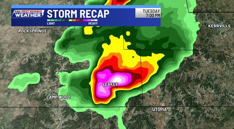
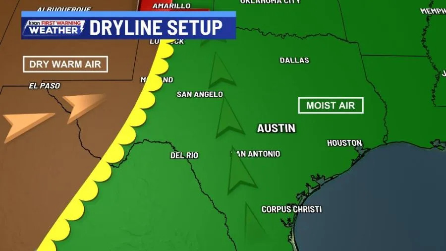
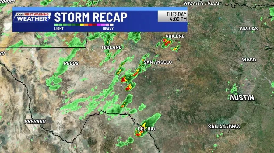
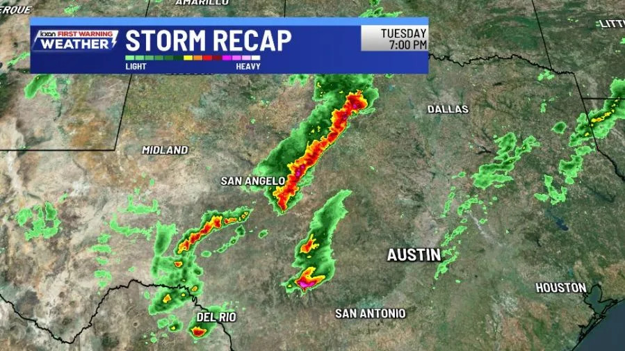
AUSTIN (KXAN) — A massive, long-tracked supercell moved across parts of the Edwards Plateau and the Hill Country on Tuesday evening, dropping large hail and producing damaging winds across several counties.

The atmosphere was primed for severe weather in Southwest Texas on Tuesday. A strong upper-level low pressure system was moving into the Lone Star State, with a dryline in the western part of the state.

At the surface ahead of the dryline, winds were backed out of the east southeast, pumping in moisture and storm instability.

On Tuesday afternoon, the atmosphere was charging for strong storms to develop. A few thunderstorms popped up in Del Rio around 4 p.m. Additional supercells fired up ahead of the dryline.

Through the evening hours, a linear line of strong to severe thunderstorms moved across North Texas, with damaging winds and large hail.

The discrete supercell that formed near Del Rio has tracked northeast across the Edwards Plateau, quickly strengthening into a severe thunderstorm.

The National Weather Service issued several Severe Thunderstorm Warnings and Tornado Warnings for this discrete, long-tracked supercell during the evening hours.

At about 7:05 p.m., softball-sized hail was measured in near Leakey, near Walter White Ranch Road.

The supercell tracked further east-northeast after the sun set, with reports of baseball-sized hail at 7:40 p.m. in Vanderpool. A storm report noted broken windshields on cars.

The storm slowly weakened through the late evening hours, however, reports of large hail were detected as far east as Kendall County.

Copyright 2026 Nexstar Media, Inc. All rights reserved. This material may not be published, broadcast, rewritten, or redistributed.

For the latest news, weather, sports, and streaming video, head to KXAN Austin.